Thunderstorms, hail, and hard rain hit northwestern Greece on Monday with the weather forecast predicting that bad weather will continue through Tuesday, spreading to the rest of the country.
At the same time, the weather forecast for next week predicts another heat wave, as the hottest summer in the past few decades continues.
The civil protection authorities have been put on alert for the bad weather that is in progress and is expected to intensify through the night.
The Hellenic National Meteorological Service (EMY) issued an emergency bulletin warning of severe weather phenomena in the next 48 hours. At the same time Civil Protection sent a 112 warning text message to residents of Western Greece announcing the .
Α special team from the Disaster Management Special Unit (EMAK) was sent earlier to Corfu island in the Ionian Sea to aid people during the extreme weather phenomena.
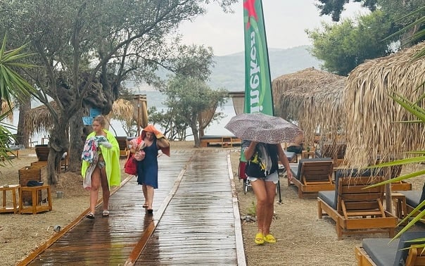
Corfu was hit the worst as heavy thunderstorms and hard rain flooded the streets on the island’s capital. The heavy downpour accompanied by lightning that occurred earlier had several gutters flood, while the center of Corfu town was left without power since 8 am. due to lightning.
In northern Corfu, a fire broke out in Avliotes village, probably caused by lightning as well. There were also problems with flight delays and cancellations at the island’s airport due to the large lightning bursts in earlier hours.
The effects are expected to intensify in central and northern Corfu through the night, with more heavy rains expected.
Thunderstorms and intense weather phenomena
Meteorologist Giorgos Tsatraphyllias who appeared on Alpha TV on Monday afternoon said that weather phenomena with intense lightning activity are expected in the next few hours, sounding the alarm for 10 regions in Greece.
The meteorologist posted on social media: “Areas with intense lightning activity in the next 48 hours will be the Ionian Sea, Aitoloakarnania, Epirus, Halkidiki, Thessaloniki, Kavala, Pieria, Thessaly, Edessa, Veria and others. Be on alert!”
Bad weather affected Patras as well, with thunderstorms and heavy rainfall. It broke out in Vrachneika shortly after 4:00 pm. In a few hours several streets were flooded.
A heavy downpour swept Ioannina as well, with water entering houses in Perama and other suburbs, while strong winds tore down rooftops and trees. A gust of wind tore off part of the roof of a building in Botanikos, Ioannina, causing the iron structure to fall onto parked car.
Overall, the meteorological service recorded more than 31,000 lightning strikes on Monday.
Earlier, an emergency bulletin from EMY reported that Central and northwest Greece will see local rains and storms through Tuesday, which will be accompanied locally by frequent lightning and local hail.
Heavy rain and storms are forecast on Tuesday in Macedonia, Thrace and possibly in Thessaly.
Βack to high Temperatures on Wednesday
After two days of thunderstorms, temperatures will rise again and stay high through the end of August, with a small cooling break on August 21-22. This is the forecast according to meteorologist Theodoros Kolydas.
According to a post by the meteorologist in social media, temperatures will be higher than normal levels for the time of the season, both in Athens and in the rest of the country and Eastern Europe.
A small and temporary drop in temperature will take place on August 21st and 22nd. The deviation from normal values in Greece is not particularly high and is estimated at around 4°C, with average maximum temperatures of 36°C.