Planet Earth is ever-changing. Over the last few years, we have seen a stark increase in sea levels, soil acidification, droughts, and extreme climate disasters.
Since we currently face extreme conditions with increased frequency, scientists have begun exploring ways to monitor these, understand their causes, and even predict when catastrophes will happen.
A proposed solution for monitoring such environmental states is Digital Twin Earth Systems. These systems are virtual replicas of the planet that merge digital models and real-world observation data to provide an accurate representation of Earth’s systems.
The technology is so sophisticated that it takes into account both natural and societal processes and helps scientists understand climate change, wildfires, and extreme weather events.
Remote sensors used to understand Earth’s changes
At the LGARSS 2024 Symposium in Athens, Professor Mihai Datcu was asked how remote sensors might be utilized to help understand Earth’s changes.
Datcu is the author of more than 800 scientific publications and has been a scientist at the German Aerospace Center since 1993. He explained, “Only the satellites of the European Copernicus program that observe each point on the Earth’s surface have captured more than 30 million images in just a few years’ time.”
Despite the amazing capabilities of these images, Datcu stated that, categorically, the images are no more than photographs. Instead, he said, satellite remote sensing is playing a major role in understanding the constant changes of planet Earth.
“Remotely sensed observation of the relevant information in applications, such as soil humidity, ocean temperature, or quantity and quality of crops (shows) how these parameters are affected while the climate is changing, and adverse natural hazards are (occurring) more often,” Datcu added.
According to Datcu, the real challenge lies in extracting important information from Big Data. It is a task that is currently impossible for humans to do by themselves.
So how can key information be extracted effectively?
Datcu explained that the information is extracted using a 2,000-year-old method of Eratosthenes, an ancient Greek polymath, mathematician, poet, and geographer.
The professor said, “Eratosthenes used an indirect observation, the shadow cast by the sun on a vertical pole at different geographical locations, and by calculation, he precisely estimated the Earth’s circumference.” He explained that scientists use a method that follows the same pattern, extracting the value of parameters of interest from remote satellite observation.
Despite the pattern being the same one that Eratosthenes used over 2,000 years ago, the availability of high-capacity computers has also allowed them to make significant advancements.
Are Digital Twin Earth Systems the key to sustainability?
Digital Twin Earth Systems are primarily used at present to evaluate climate models and describe long-term changes at a scale of thousands of miles.
Datcu explained:
“The DTE systems implement a virtual, dynamic model of the world, continuously updated, enabling simulations while providing more specific, localized, and interactive information on climate change.”
Essentially, these systems will allow us to decide on how to act in any given situation, as well as consider contingency plans for more severe scenarios.
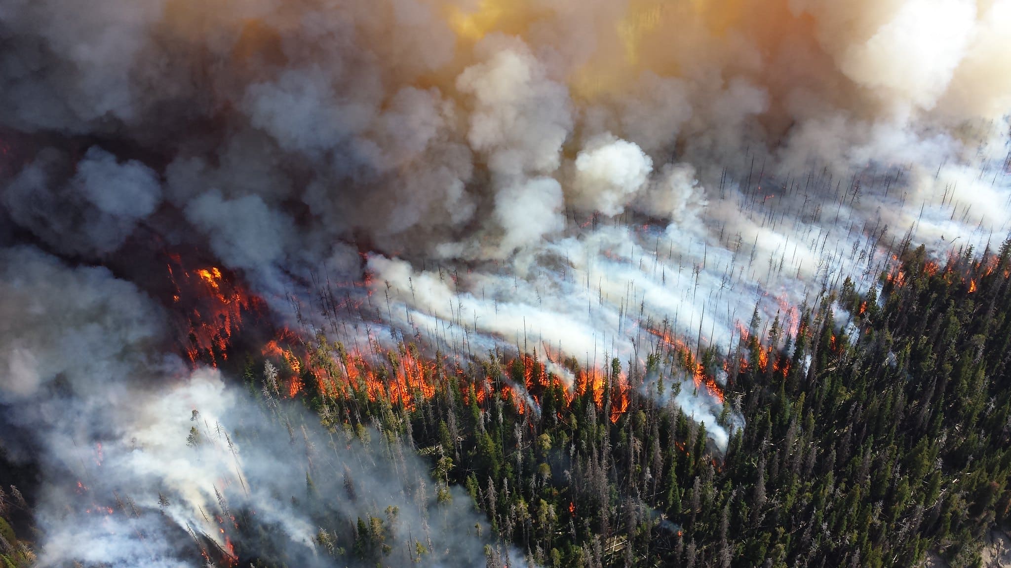
According to Datcu, “An example, is how crop production will evolve if drought is becoming excessive, or estimate forest damage (due to) wildfires.”
DTE tools are also used as a tool to raise awareness. According to Datcu, amplifying the use and knowledge of climate data will be crucial to encouraging citizen-driven approaches to climate change.